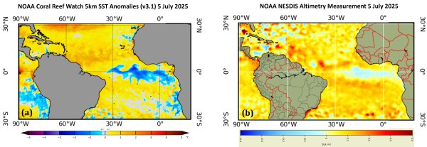
Atlantic Niña is a natural climate pattern characterized by cooler-than-average sea surface temperatures in the eastern equatorial Atlantic Ocean, appearing predominantly in June-August. It is considered the 'cold phase' of the Atlantic Zonal Mode, the leading mode of tropical Atlantic sea surface temperature variability in June-August, similar to how La Niña is the cold phase... Continue Reading →
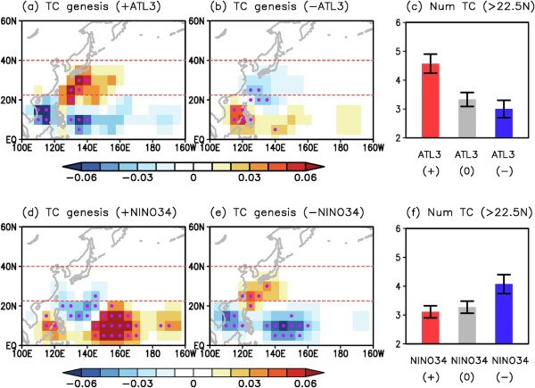
Onset of 2025 Atlantic Niña and its implication for typhoon landfalling risks in East and Southeast Asian countries